Editor’s note: Liesel Nygard, the author of this article, also authored the mentioned opinion piece.
A recent Collegian opinion piece explains why the University of Massachusetts campus needs an app to help with finding study locations. Once the article was published, a group of students reached out and explained their mapping app creation for the UMass community that could help individuals on campus find their way to classrooms, events, dining locations and more.
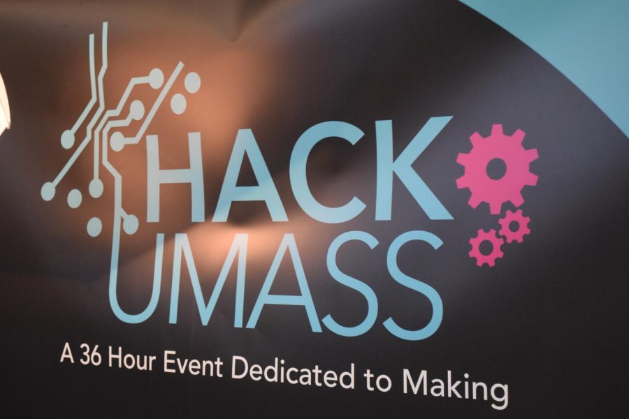
Campus Atlas, designed by five students, has the purpose of mapping out locations for those on campus, so that it is easier to navigate. The app was designed back in Nov. 2021 during the HackUMass IX competition, where the designers worked for 36 hours to map out two floors of the Integrative Learning Center as their prototype. Their project won the grand prize and the Best Software Hack category prize.
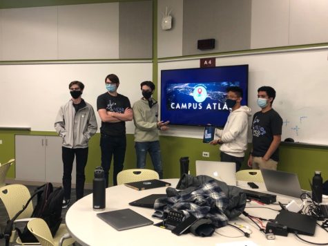
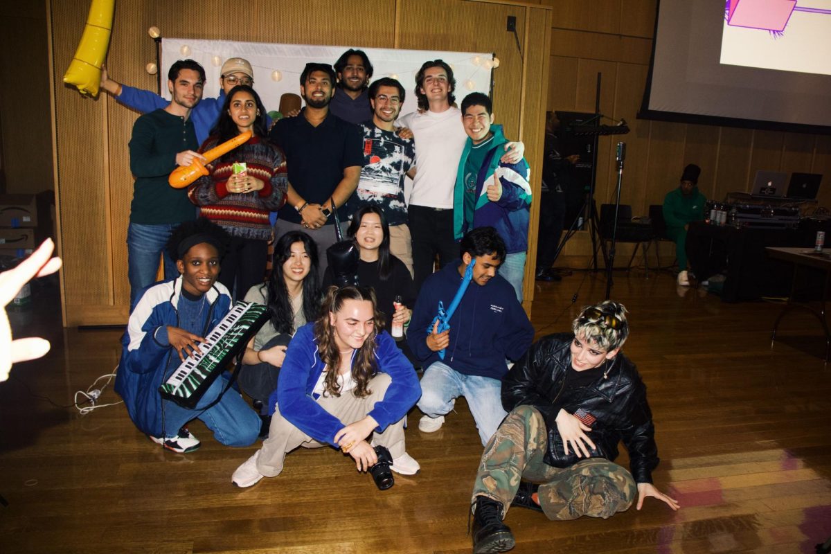
During the HackUMass IX competition. From left to right, Ben Burns, Conlan Cesar, Nic Asnes, Larry Tseng, and Rohan Bapat. Photograph from Larry Tseng.
“We all had experienced at one point in our college career, where we couldn’t find a certain classroom or find a building on campus because there’s just so many. And there weren’t any good solutions that UMass currently offers for finding your way around campus. That’s why we came up with this idea,” explained team member Larry Tseng, a junior management and computer science major.
Tseng explained a survey he created for a past management class. The survey was about the confidence level UMass students have with finding a new classroom. He said of those 30 responses, the average confidence level was 2.7 out of five, showing a 54 percent confidence rate.
In non-technical terms, Campus Atlas would provide users with a search bar, allowing them to type in any words that could match the building or classrooms. Hitting “search” would then produce a list of options would show up and you pick which location you want. The search field would provide additional information such as the building name and office hours.
Along with mapping the campus, the app would show accessibility options throughout the building, like stairs and elevators. Other search options for students and faculty could be study locations, places to eat or water fountains.
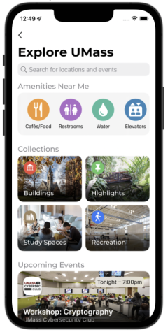
Campus Atlas would be able to take coordinate positions and find locations that are near them. The app would identify the buildings nearby and the ones most relevant to you based on search history, rather than loading every building that’s mapped. To prevent outside information from showing up, the app would only show the UMass campus locations.
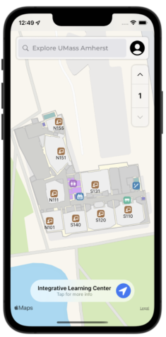
“The app is an actual map. So, the base map would be Apple Maps or Google Maps, and then we would put on top our points and our coordinates. And that’s why it’s important to get those coordinates so that they line up with the actual building in Apple or Google Maps,” Tseng said.
In technical terms, when the app was created for the ILC, the team used an image of the building and put it on top of the ILC in the Google Earth program. They next traced all the corners of the building and rooms by clicking the corners with their mouse and then exported this file from Google Earth, creating a KML, which stores all the building’s information from Google Earth. With this KML, they assigned coordinates and labeled the individual rooms in the ILC. Next, the team wrote pieces of code that would take a file from the KML format and convert it into an indoor mapping data format (IMDF). The IMDF is what allows users to zoom in on the map and do things like view the building’s floors, rooms and its accessibility.
“The main focus of Campus Atlas in terms of a scalability thing is we’ve now put in most of the effort to develop this pipeline of data to map and then once we have that, finalized, then we can later work on key customization,” team member Ben Burns, a sophomore mathematics major, said.
The team is still in the process of creating such a tool. They said that the customization they want to pursue will depend on whether they work with the University or not. If it is a campus-wide initiative, they will have a lot of options for customization.
One potential idea the team had was allowing students to use their SPIRE logins for the app so that it’s safe and secure for the student. When asked about privacy settings, they said the app would not store or broadcast personal information. It will be saved on your personal device, and no one else’s. They have thought of a feature, however, where friends and family could ask permission to share their current location with you. You could also be given the option of sharing your current location with emergency services.
The team said that Campus Atlas could have the ability to display events that users may be most interested in and be shown directly on the map so that it is easier to navigate. Authorized users can sign up and create events on the app which allows them to display the room number and time. This could be anyone from a student club officer to a university employee. The event would then be approved by the app’s owners before it is projected on the map.
They would also like to add indoor positioning. This would be what room or floor you are on. With UMass’s permission, the members can use wi-fi router signals and access point signals to find your exact location. They also want to make a feature that allows you to find the quickest route to your destination.
Team member Nic Asnes, a senior computer science major, said that in the future, the team would like to create a more efficient way of mapping for the app by using other kinds of formats. These would include floor plans or other formats that already have stored coordinates, instead of a picture. This way, the team could automatically convert the coordinates and information rather than manually overlay the image and pin the room’s corners.
Team member Conlan Cesar, a junior computer science major said that an official proposal of this app has not been made yet, but when they discussed their idea with other employees and students on campus, they all seemed interested.
“We’re still somewhat in the research and development phase, trying to figure out what exact approach we want to take. So, there are lots of options,” Cesar said.
“We are really, really interested in this. And I think that we believe in it as a product. We think this is a good idea and it would help people,” Asnes said.
Liesel Nygard can be reached at [email protected] and followed on Twitter @LieselNygard.